Zeefzorpul Locations
Return to: Witches Apprentice
| The following maps show all the know locations where Zeefzorpul the Imp can be hiding.
Click on any of them to see the location on the zoomable map.
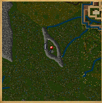
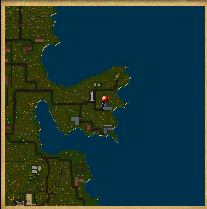
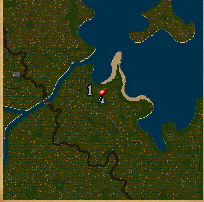
The Bridge of Two Kings west of Dungeon Destard.
(91° 40′ S, 22° 4′ W) |
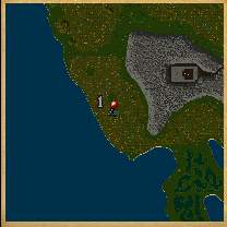
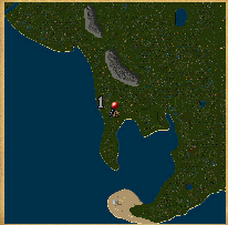
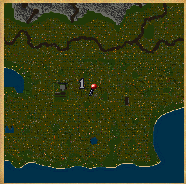
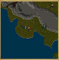
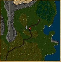
A farmhouse west of Lord British’s Castle.
(4° 34′ N, 6° 40′ W) |
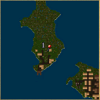
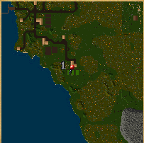
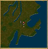
A small cave east of Dungeon Destard.
(96° 35′ S, 3° 1′ E) |
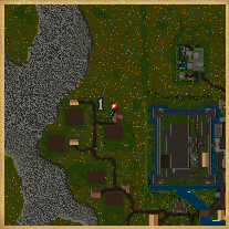
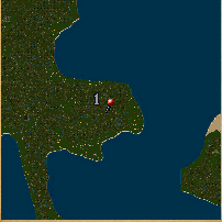
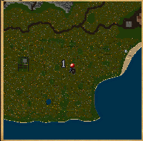
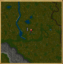
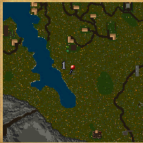
A guard outpost on the road east of Yew.
(66° 21′ N, 4° 38′ W) |
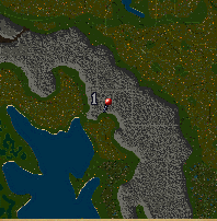
The mage tower in Hidden Valley west of Trinsic
(119° 37′ S, 24° 45′ E) |
The ruins northwest of the Honor Shrine.
(153° 37′ S, 20° 6′ E) |
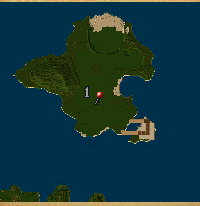
The stable of the eastern farm on the north Jhelom Island.
(173° 19′ S, 10° 41′ W) |
The ruins in the jungle far east of the Honor Shrine.
(153° 16′ S, 60° 7′ E) |
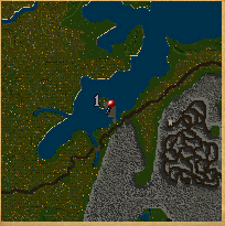
The ruins south of Dungeon Covetous.
(45° 52′ E, 83° 40′ E) |
The ruins west of Vesper.
(44° 28′ N, 88° 31′ E) |
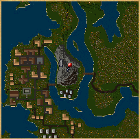
Just north of the mage shop in Magincia.
(50° 26′ S, 167° 24′ E) |
The mines east of Minoc.
(101° 51′ N, 88° 56′ E) |
The house south of the telescope at Moonglow.
(39° 6′ N, 123° 33′ W) |
The ruins west of Dungeon Shame.
(2° 38′ S, 59° 37′ W) |
A field at the farms southeast of Skara Brae.
(69° 20′ S, 30° 9′ W) |
The ruins west of the Shrine of Spirituality.
(77° 41′ S, 10° 20′ E) |
A tent north of the Shrine of Spirituality.
(46° 45′ S, 18° 50′ E) |
A guardpost near the Bog of Desolation northeast of Britain.
(41° 55′ N, 42° 49′ E) |
The trapper huts south of the Shrine of Sacrifice.
(92° 27′ N, 142° 6′ E) |
The ruins south of Yew.
(27° 35′ N, 53° 5′ W) |
|
Last modified: April 1, 2011


can not find lev 1 t map and where they are ?
1Try this page http://uo2.stratics.com/skill-guides/skills-and-professions/treasure-hunter/treasure-map-quests
2